

Outdoor Trail Maps Maroon Bells-Snowmass Wilderness – Colorado Topographic Hiking Map (2018)
$8.95


Price: $8.95
(as of Mar 22,2022 13:56:18 UTC – Details)

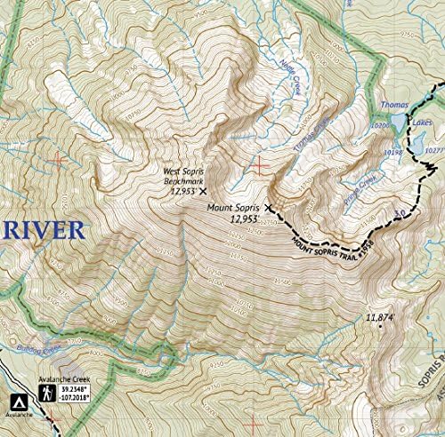
Waterproof, tear-resistant topographic hiking map covering all of the hiking trails in the Maroon Bells-Sowmass Wilderness south of Aspen and north of Crested Butte in the Elk Mountains of Central Colorado. The front side of the map covers the western side of the wilderness, including Mount Sopris (south of Carbondale), Lead King Basin, Snowmass Lake, Geneva Lake, Capitol Peak and the Capitol Creek Trail, etc. The back of the map shows the eastern half of the wilderness including Conundrum Hot Springs, the Maroon Bells, Pyramid Peak, Castle Peak, Cathedral Lake, Electric Peak Pass, Crater Lake and more.
Waterproof, tear-resistant, 1:50,000 scale with a compact 4″x7″ folded size for your pocket
Smaller and lighter – no more unfurling huge maps – designed for on-trail use
Segment distances – mileage – for all trails
Updated for 2018 with accurate trail routings and distances
GPS coordinates for trailheads and trail junctions – device compatible
Related Products


$8.95